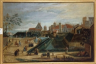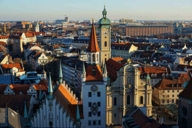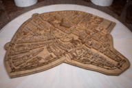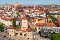
Up to the end of the 18th century, Munich looked very different from its appearance today. A map from 1740 depicts the city in a manner that closely resembles a successfully completed fortress in the popular board game “Carcassonne”: the imperial seat of the Wittelsbach Electors was then completely encircled by a weir system of ramparts, defensive Zwinger walls, towers and gates. Bringing that medieval city back to life requires a little imagination, and an observant eye for the traces that remain.
- Munich's first city wall
- Tracing the first city fortification
- Expansion of the city in the 13th century
- Vestiges of the second fortification
Though city views depicting idyllic nooks and crannies along the city walls were produced by artists such as Carl Spitzweg (born in Munich in 1808) and his contemporaries, in actuality such scenes were already being consigned to history from 1790. That’s when the city’s fortifications started to be gradually removed on the orders of Elector Karl Theodor; he wanted to bring light, air and free movement into the city and the walls stood in the way of that purpose. Eventually all that remained were the Isartor, Sendlinger Tor and Karlstor (gates), as well as a short section of the city wall on Jungfernturmstrasse near the Literaturhaus (Literature House).
King Ludwig II of Bavaria arrived 100 years too late to save it, though we can surely assume that his love of all things medieval would have led him to resist these demolition plans, just as he did in the case of the Nuremberg city wall.

The first records of a city wall date from the late 12th century, less than twenty years after the establishment of Munich Market. That original wall was only around one and a half kilometres long. Today, street names such as “Hofgraben” and “Färbergraben” – translating as courtyard moat and dyers’ moat – offer clues to the course of the former wall, as well as confirming the existence of the “Wassergraben”, or moat itself. It takes about an hour to take a leisurely stroll around Altstadt to explore this oldest part of the city.
Another remaining echo of the historic city fortifications can be observed in street names which change at the locations of former city gates – this can most strikingly be seen in the Fußgängerzone (pedestrianised area) between Marienplatz and Karlsplatz: where Kaufingerstrasse becomes Neuhauserstrasse, on the site of what is now the Hirmer department store, the Schöner Turm ("beautiful tower") gate once stood. A marker on the pavement commemorates the tower’s location until its demolition in 1807, while on the corner of the building itself there is a miniature representation of the tower as it once appeared.
Traders had to pay their tolls at Talburgtor gate before they were permitted to proceed to Marienplatz. In the 15th century, the Old Town Hall was built on its site and destroyed in the Second World War. Its tower, which was only rebuilt in the 1970s, now houses the Toy Museum.
The original city wall ran from Marienplatz, along Burgstrasse to the Alter Hof, the former seat and residence of the Wittelsbach rulers. During reconstruction of the city in the 1950s, it was discovered that a number of medieval townhouses had been built directly against that first city wall, thereby saving the trouble of building a back wall to the dwellings. A piece of the city wall can still be seen through the passageway in the backyard of Number 8 Burgstrasse.
The Alter Hof was itself integrated into the fortress, however it was also separated from the city by a trench, to protect it against civil uprisings. The cellar of the Burgstock wing of the complex now houses the Bavarian Museum & Castle information point (Infopoint der Museen & Schlösser in Bayern), and a fragment of the southern 12th-century defensive wall can also be viewed there. The “Münchner Kaiserburg” (Munich’s imperial castle) permanent exhibition in the late-Gothic vaulted hall also includes multimedia exhibits about the city’s oldest rulers’ residence, its most famous sovereign Emperor Ludwig of Bavaria, and about the history of the city of Munich.
At the Rindermarkt, just a few minutes from Marienplatz, stands the imposing Löwenturm tower. Contrary to popular belief, this tower was never part of the city fortifications. It is thought that the structure was originally built in the estate gardens of a renowned Munich patrician family named Pütrich, who used it as a storehouse, water reservoir and, in the northern Italian tradition, a status symbol.
Although there is no longer much to be seen at street level, construction-related excavations regularly uncover foundations from the original city fortifications. Also beneath the pavements here, numerous streams and tributaries of the Isar river still flow beneath our feet, centuries after their supply was used to fill the city moat, clean the medieval city and support many craft industries. There is currently discussion about partially bringing these waterways back to the surface to help cool the city in summer in particular, given the effects of climate change.

As the trading town of Munich grew and flourished, the number of people settling there increased too. A hundred years on, in the mid-13th century, construction began on a second, more extensive ring wall under Elector Ludwig II (Ludwig the Strict). This phase of works ended with construction of the Isartor gate, which was completed in 1337.
In the 15th and 17th centuries significant expansions were carried out in order to meet heightened defensive requirements. The city moat was filled in and a defensive Zwinger wall with 44 additional towers was constructed parallel to the city wall. Additional round towers were constructed at the exposed corners. The names of these towers and features can still be seen in local streets such as Jungfernturmstrasse, Falkenturmstrasse, Neuturmstrasse, Am Kosttor and Zwingerstrasse.
Following the outbreak of the Thirty Years’ War, between 1619 and 1640 Elector Maximilian I added ramparts, bastions and a moat up to 30 metres wide, which could be filled from the city’s streams. The Dichtergarten (Poets’ Garden), which is open to the public, is the only surviving bastion from this 17th/18th-century fortification.

In addition to a short section of the second ring wall on Jungfernturmstrasse, there are a number of other traces of the second city fortification to be found near the Isartor gate. Sited north of Isartor, the highest tower along the structure was known as the “Lueg ins Land” watchtower; one wall of this structure forms the southern wall of the property now located at Marienstrasse 21. Wall paintings and a stone plaque on the neighbouring building (Vindelikerhaus) mark the site of the city tower.
The foundations of a turret from the same period are evident just nearby, in the inner courtyard of the building at no. 3 Thomas-Wimmer-Ring. Remnants of the city wall were integrated into the building constructed at No. 1 Thomas-Wimmer-Ring in the 1980s, and are viewable there today through the glass façade.
Other articles that may interest you: The Münchner Stadtmuseum (Munich City Museum) houses the permanent exhibition "Typically Munich“ featuring numerous paintings of medieval city views. The Bayerisches Nationalmuseum (Bavarian National Museum) has the original Sandtner city model dating from 1570 on display, as well as an interactive model recreating 19th-century Munich with its Baroque ramparts still intact. The Rittersaal (Knights’ Hall) contains a collection of historic weapons which were used from the walls to defend the city.